
Shrayan Sen
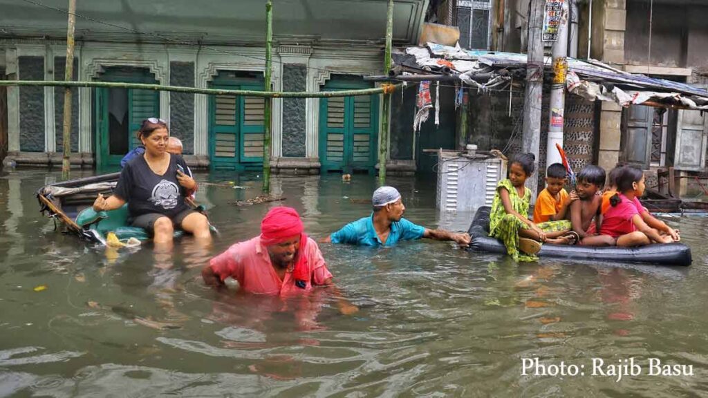
Residents of Kolkata woke up on Tuesday to a city under water. Hours of relentless overnight rain left roads, markets, and homes inundated, with traffic paralyzed and daily life thrown into chaos. The deluge, weather experts say, was caused by massive cumulonimbus clouds that formed over the city late on Monday night and unleashed one of the heaviest downpours in recent years.
The perfect recipe for a downpour
The super heavy rain can be traced to a low-pressure system brewing over the northeast Bay of Bengal. Such systems are common during the monsoon’s retreating phase, but this one came at a time when the atmosphere was unusually unstable. The low pressure dragged in huge volumes of warm, moisture-heavy winds from the Bay.
As these moist winds travelled inland, they met other air flows and began to clash. This clash, known as moisture convergence, meant the air had no option but to rise. Rising air cools quickly, and the water vapour inside it condenses into clouds. But on Monday night, the unstable conditions in the upper atmosphere made the process much more violent than usual.
Once the upward motion began, it accelerated dramatically. The warm surface air kept feeding the process, while the cooler upper layers helped the clouds grow taller and taller. Within a few hours, the sky over Kolkata was dominated by towering cumulonimbus clouds — thunderclouds that can rise 12 to 15 kilometres into the atmosphere.
These clouds are infamous for their power. Inside them, strong updrafts and downdrafts create turbulence, lightning, and, most critically, sheets of rain that fall at extraordinary speeds. Unlike steady monsoon showers, cumulonimbus storms tend to pour massive amounts of water in very short bursts, overwhelming cities like Kolkata where drainage systems are already stretched.
A city drenched in hours
The IMD’s Alipore weather station recorded 251.4 mm of rain by 8:30 a.m. on Tuesday, most of it falling in just a few night-time hours. For many neighbourhoods, it felt as though the skies had ripped open — torrential rain pounded without pause, drowning out even the sound of traffic. In southern locality of Garia, a whopping 332 mm of rain within a span of five hours.
The sheer intensity of the downpour left the city’s infrastructure defenseless. By midnight, water had begun to flood into homes and shops. Vehicles lay half-submerged, and familiar thoroughfares like Gariahat Road, Tollygunge Circular, and Park Circus resembled shallow rivers. Commuters returning home late at night were stranded as buses broke down and app cabs refused trips into waterlogged zones.
The city’s famed Salt Lake township, built on reclaimed marshland, saw large stretches inundated. Families reported water entering ground-floor flats, while shopkeepers rushed to salvage goods as their shutters rattled under gushing water. By dawn, vast pockets of south and central Kolkata were waist-deep in water.
Not a Cloudburst
While many residents claimed cloudburst has stuck Kolkata, it was officially and technically not so. Instead, it was an intense convective downpour triggered by the Bay of Bengal low-pressure system and powered by violent moisture convergence. The atmosphere was primed for a deluge. Once the clouds grew, the rainfall became unstoppable through the night.
Enriched. Thank you for the this report.